1
26
Can you hear this picture? (images.universal-music.de)
submitted 13 hours ago by Blaze@lemmy.cafe to c/yurop@lemm.ee
2
17
submitted 2 days ago by Servais@discuss.tchncs.de to c/yurop@lemm.ee
3
68
submitted 6 days ago by Servais@discuss.tchncs.de to c/yurop@lemm.ee
4
11
submitted 1 week ago by Sagan@lemm.ee to c/yurop@lemm.ee
5
198
submitted 1 week ago* (last edited 1 week ago) by Servais@discuss.tchncs.de to c/yurop@lemm.ee
6
8
Do you remember Huawei? (pagenotfound.cz)
submitted 2 weeks ago by plactagonic@sopuli.xyz to c/yurop@lemm.ee

Long read about the Huawei bans and the political cluster fuck in my country.

Sorry I'm on mobile so no translation.

7
79
submitted 2 weeks ago by Servais@discuss.tchncs.de to c/yurop@lemm.ee
8
62
submitted 2 weeks ago by Blaze@feddit.org to c/yurop@lemm.ee

!latvija@lemmy.world

9
51
submitted 3 weeks ago by Servais@discuss.tchncs.de to c/yurop@lemm.ee
10
67
submitted 3 weeks ago by Servais@discuss.tchncs.de to c/yurop@lemm.ee
11
91
submitted 1 month ago by Servais@discuss.tchncs.de to c/yurop@lemm.ee

Düwag GT6 Be 4/6 (31):

Production year: 1967.

Total vehicles: 8

Garage numbers: 2603, 2605, 2611, 2613, 2615, 2618, 2620, 2622

Production year: 1972.

Total vehicles: 23

Garage numbers:2123, 2133, 2135, 2143, 2625, 2626, 2629, 2630, 2632, 2634, 2639, 2640, 2644, 2646, 2647, 2649, 2650, 2651, 2652, 2653, 2654, 2655, 2658

Combined with trailers: 2123+1448, 2133+1440, 2135+1475, 2143+1429, 2603+1425, 2611+1431, 2615+1447, 2620+1445, 2625+1441, 2626+1473, 2629+1474, 2632+1444, 2634+1405, 2639+1476, 2640+1449, 2644+1495, 2647+1472, 2650+1484, 2651+1494, 2652+1479, 2653+1477, 2655+1471.

12
324

In Simiane-la-Rotonde, Alpes-de-Haute-Provence, France

13
106
Gordes, France (lemmy.world)

Cycled through there yesterday. Very tourisitc village, but it looks pretty great too.

14
78
submitted 1 month ago by Blaze@lemm.ee to c/yurop@lemm.ee
15
16
submitted 1 month ago by Blaze@sopuli.xyz to c/yurop@lemm.ee
16
9
submitted 1 month ago* (last edited 1 month ago) by Servais@discuss.tchncs.de to c/yurop@lemm.ee
17
12
submitted 1 month ago by Servais@discuss.tchncs.de to c/yurop@lemm.ee

Just stumbled upon this video, well done Dutch people

18
41
19
50
submitted 1 month ago by noodlejetski@lemm.ee to c/yurop@lemm.ee

cross-posted from: https://lemm.ee/post/42694373

Leak on latest #ChatControl attempt (in German): https://netzpolitik.org/2024/interne-dokumente-sperrminoritaet-gegen-chatkontrolle-wackelt/ +++ Only AUT, DEU, EST, LUX, POL, SVN were critical – no blocking minority! +++ BEL, CZE, FIN, ITA, NLD, PRT, SWE undecided +++ EU legal experts confirm violation of our fundamental rights +++ Only 5 days to next discussion +++

Help pressure our governments into defending our #privacy of correspondence and secure #encryption now: https://www.patrick-breyer.de/en/take-action-to-stop-chat-control-now/

20
21
submitted 1 month ago by Servais@discuss.tchncs.de to c/yurop@lemm.ee

This storm looks scary

21
101
Priorities (sopuli.xyz)
submitted 1 month ago by plactagonic@sopuli.xyz to c/yurop@lemm.ee
22
116
submitted 1 month ago by Servais@discuss.tchncs.de to c/yurop@lemm.ee
23
118
This is fine. (sopuli.xyz)
submitted 1 month ago by plactagonic@sopuli.xyz to c/yurop@lemm.ee

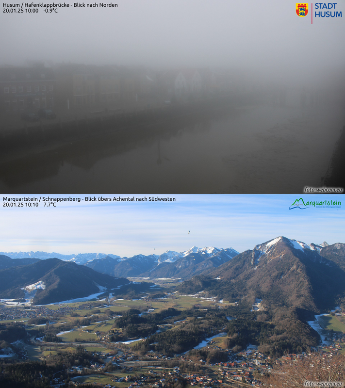
I wish that you all have nice weekend weather.

24
15
submitted 1 month ago by Sagan@lemm.ee to c/yurop@lemm.ee
25
58
submitted 1 month ago* (last edited 1 month ago) by Servais@discuss.tchncs.de to c/yurop@lemm.ee

Source: https://old.reddit.com/r/MapPorn/comments/1fdij5t/historical_regions_of_europe_beta_version/

Seems to be quite a few litigious points, especially

  • Lombardy / Tuscany
  • Slovakia
  • Galicia in Poland
  • Scotland
  • Etc.

I'll follow up on this thread and post the updated version if the author updates it

Additional input from the author

Here is the explanations comment

The main reference maps are here.

This map is based on geographical/historical/cultural regions division of Europe. The base canvas that has been used is Europe-Detailed from MapChart and it sucks because every country is overstretched with some parts like Germany and the Balkans being highly deformed. The overstretched Scandinavia was so unworkable I replaced it with HOI4 MapChart (it was already too late when I discovered MapChart has Paradox Interactive maps). If I make a final version, I will probably use HOI4 provinces as my base canvas because they provide enough fragmentations and countries are not that much deformed.

Since this map is intended to be used for studying History, I tried to focus on historical regions (which are often cultural regions too). When I couldn't use historical regions because it was too complex or because of a lack of data, I resorted to geographical regions.

So, now here are some details about the regions I chose to display :

  • Sweden is not finished. Here is the map I planned to use as my reference for Sweden.
  • I am still struggling to understand if the borders of the federations composing current North Caucasia are historical borders or if they were imposed by Moscow after some forced ethnic migrations. So I chose the easy way and displayed the geographical regions.
  • Germany's regionalism is hell because of the HRE. So I assumed that people who are interested in the HRE should rather use more specific maps instead of mine. The regions displayed on my map come from a mix between dialect maps and political entities that have been around for a long time. Brandenburg and Upper Saxony are overstretching on their western part because I didn't know what to do with Sachsen-Anhalt.
  • Russia is largely blank because of the lack of data. From what I understood, people in Russia use either big cities or uezds to refer to a specific location. Using uezds would be the most accurate solution but I am not familiar enough with russian geography to work with such a fragmented Russia so for the time being, I decided to display current oblasts that approximately correspond to either one of the main principalities of the Kievan Rus.
  • The Balkans map is mostly based on geographical regions. I am still unsure for Alföld. Gorica is not displayed because it is too small. Baranya is not displayed because the Croatian-Hungarian-Serbian border is already too complex. The coastal region of Toskëria should be Myzeqe but I decided to not display it for now because it was rather small.
  • For Switzerland (whose key has been rendered unreadable by the compression) I kept the current county division

If you want to make an improved map or a variation map, feel free to use this unfinished map.

Note : If you have some remarks, I think it would be better to write them on a separate comment and not reply to this one to avoid creating an unending thread of replies.

Note 2 : Feel free to provide more detailed maps of specific regions of Europe, it may save some time for people struggling to find what they want.

view more: next ›

YUROP

1200 readers
65 users here now

A laid back community for good news, pictures and general discussions among people living in Europe.

Other European communities

Other casual communities:

Language communities

Cities

Countries

founded 9 months ago
MODERATORS