everydayhiker

joined 2 weeks ago
 

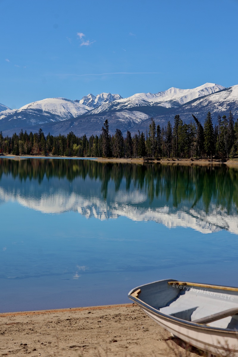
Another short but steep hike in eastern Jasper National Park, this hike takes you to a valley nestled under Roche Miette before you get to the bald up top. Much less intimidating than the wall on Morro Peak, but just as physical. One ladder section is easily climbed along the way and you may see some mountain goats while you’re up there! Hopefully he doesn’t see you eat it on the muddy slope like he did for me! At the trailhead is a great spot to watch Bighorn as well.

The ladder chained to the rock face leads to a slippery section made easier by the heavy duty chains running the length of it.

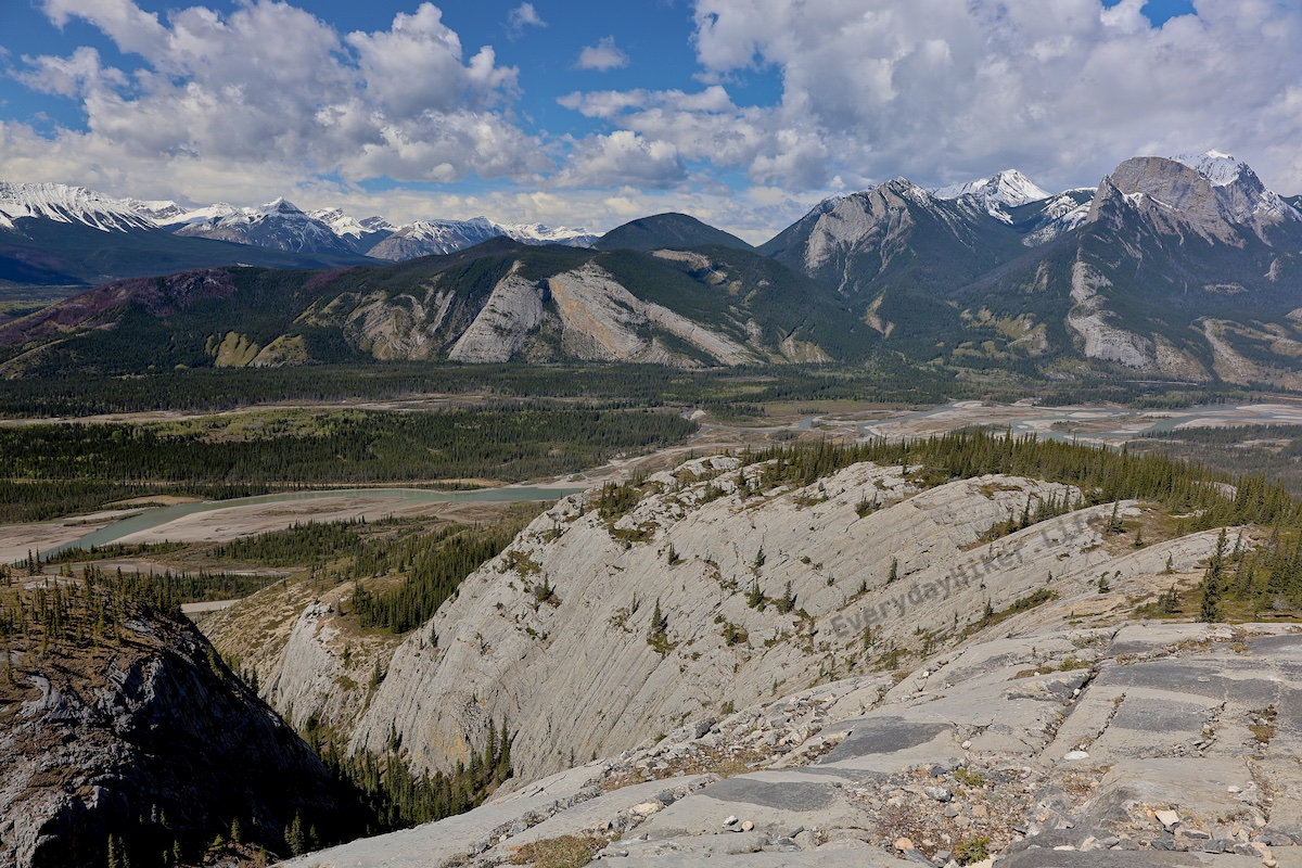
Looking back towards the Athabasca river valley below. The trail is in the lower valley and not on top of the ridgeline.

A look back towards the highway shows how quickly this trail rises before entering the canyon. The Athabasca river valley sprawls below.

[–] everydayhiker@lemmy.world 0 points 14 hours ago

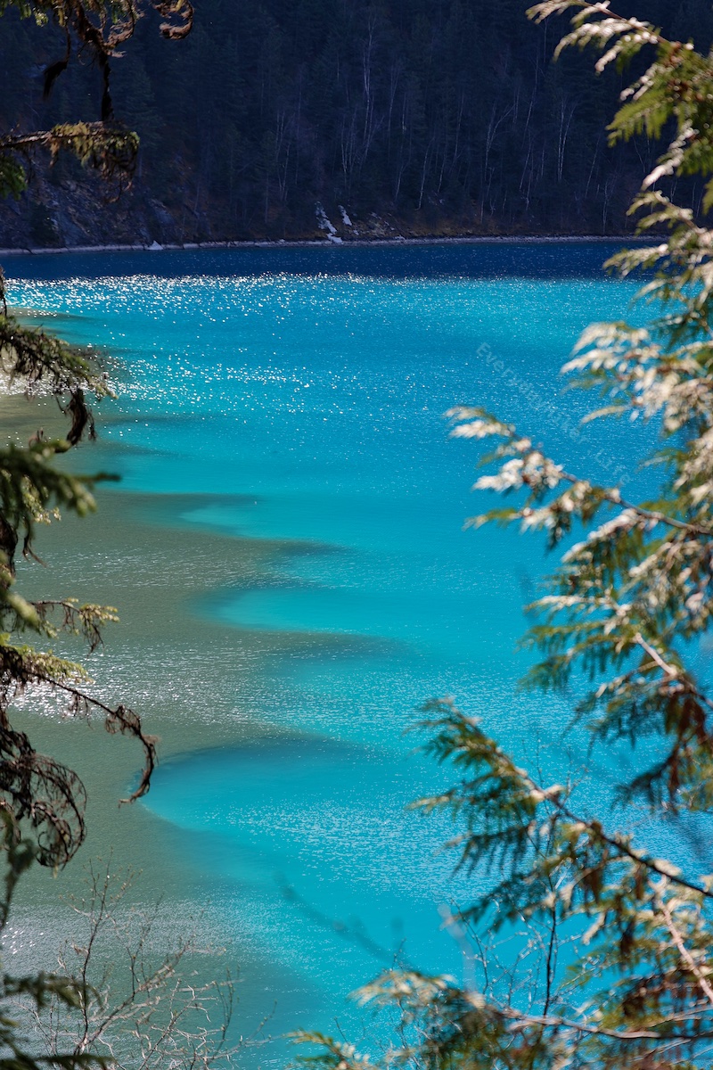
Yeah, as posted above, its in the Canadian Rockies.


Covering a lot of elevation in a short span, this #hike has you wrap around the sheer wall face before ascending to the large bald above the Athabasca river valley. While moderate, the 2k ft gained in less than 2 miles (3.4 total) leads to some steep sections. Hiked 5/11/25

The view to the west towards Jasper from the viewpoint on top of Morro peak.

A nice viewpoint if you can stand it as you wrap back down along the cliff face. While steep and loose, the trail here is four feet wide so it's easy to look away from the open drop below.

Looking up at Morro peak. The trail goes up the left side until around the tree line before crossing to the rught and up and then wrapping up the right edge of the rock wall.


Starting with a quick bridge crossing onto the small Pyramid Island, this trail returns to the mainland before rising above the town of Jasper to some great overlooks. Bighorn sheep may be seen on this trail as they frequent the area. This area of Jasper gets super busy with limited parking, but you can start it from any of the small lots along the lake.

Rust-specked Pyramid mountain dominates the frame with what remains of its snowpack.

A view of the Athabasca river flowing away and towards the town of Jasper, with mountains of the northern edge of the Icefields Parkway beyond.

A collection of Bighorn rams grazing on the hillside. This area and to the east is filled with Bighorn.


This 6 mile out and back trail will take you past the Sulphur Gates into the , a cool looking geological feature shaped by water, to a waterfall that has carved the rock into an intriguing spiral pattern.

A photo showing the lower and middle sections of Eaton falls as you approach from a distance.

The way the small canyon warps up around the waterfall is hard to convey. Me for scale.

The Sulphur gates, formed as water cut through the ridgeline to merge the rivers below.

Kind of out of the way to get to, I mostly went here as I was stalling for time for snowmelt. The waterfall itself was very cool though.

May miss tomorrow, not sure if I’ll get back to service or not (Kootenai NP).


An extremely popular trail around Edith Lake just east of the town of Jasper, this 3.6 mile loop can be broken into any number of sections along the lake shore. On May 5th, the crowds had yet to arrive in full force. The hike itself its pretty basic, but it’s got great views and a good chance to see various wildlife.

A canoe sitting in front of the reflective Edith Lake.

The turquoise waters of Edith Lake in front of Mt Edith Cavell.

Pyramid Mountain as seen from the northside of Edith Lake.


Located not too far from the Sunwapta falls, Athabasca falls is a popular waterfall on the icefields parkway. At just half a mile round trip to the falls, it is great for a quick visit. Continuing upstream from the falls may give you a chance to separate from the crowds while seeing magnificent views of Mt Geraldine and surrounding peaks. There is also an area that lets you check out the slot canyon downstream, but it was still closed when I went there on May 4th. The falls itself was decent, but the whole area would be great for a picnic, which could pretty much be said for any stop along the parkway.

Athabasca falls rushing with Mount Kerkeslin in the background. The jagged nature of the rock here is because it is made of hard gog quartzite being sheared off as opposed to more smoothly eroded.

The top of Athabasca falls. While the other side is gated off, this has pretty easy access.

The slot canyon being formed downstream of Athabasca falls.


Sunwapta Falls Easy two mile out and back trail located along the icefields parkway south of Jasper. The main falls are located at the beginning of the hike and the trail follows along the river downstream, revealing several more waterfalls as you go. River access can be had at the end of the trail as it leaves the canyon. The upper area gets a ton of usage, as does the second falls which are fairly close by and have a good viewing area. Thins out a little beyond that, but its a short hike so stays fairly busy.

The second falls (not including the big chute that comes out from the upper falls). Drops around 15 ft before going into another chute.

The outflow from the uppermost waterfall rushing under the bridge above. Over time it has carved a curving path into the rock on the side with this viewpoint.

Looking downstream from this large waterfall just off the trail. When hiking, you will be afforded other angles of the falls as you continue the trail. The Catacombs Mountains can be seen in the distance.

[–] everydayhiker@lemmy.world 1 points 1 week ago

Would love to do the whole thing someday. Super jealous of the 2018 trip you had. Yeah, I’d like to see photos with before/after.

[–] everydayhiker@lemmy.world 1 points 1 week ago

Oops, yeah somehow I had it as whitehorn mtn, whitehorse cg, and white falls (which i believe is still correct). Thought that was a bit much. Glad I was wrong.


Berg Lake trail to Whitehorn campground The next chunk of the Berg lake trail goes from Kinney Lake up to Whitehorn campground. Situated in the valley of a thousand waterfalls, it is hard not to be awed by the surroundings. Trail closed at the CG on 5/2/25, it is now open again. Would love to do the entire thing. While up here, I managed to see some avalanche blasting, which can be seen on the videos post, link is also Here. Put it on the video post as well, but anyone know any peertube instance i can upload to? I’d be happy to switch, although I may also post videos to youtube for greater accessibility.

Extra photos include two views of the surrounding mountains, one with the avalanche still flowing and the other looking up towards mt Robson.


Avalanche blasting along the Berg lake trail in Mt Robson Park. Managed to catch some blasting in early May, heard the thoomp and sprinted out of the tree line as fast as I could to track down the fallout. One of my buddies used to do this on Mt Hood back in the day so I knew what was happening as soon as I heard it. Taken at the Whitehorn campground. Trail was still closed beyond this point when I was there.

..is this the best way to upload videos? If someone knows a peertube instance I’d be gappy to switch.

[–] everydayhiker@lemmy.world 2 points 1 week ago

No, it’s something I’ve noticed too as I’m seeing them posted. Think I need to adjust display settings on the monitor because they seem less so on it, and generally just get better at it as well. Thanks for the advice!


Located in Mount Robson park, this moderate hike is an ~8mile out and back trail at the amazing campground on the far shore of the stunning blue lake. Hiking this is a must do if you are traveling in the area. Is part of the larger berg lake trail. I continued on to whitehorse campground before it was closed due to avalanche blasting (i’ll post the video). Tomorrow I’ll post the trail from beyond just kinney lake trail, which i think is how I will break up trails that continue past.

When I hiked this on May 2nd, the melting runoff caused a temporary creek to flow into the lake, bringing with it large amounts of silt. The plume could be seen from across the lake and I thought it was just the coolest thing.

Extra photos are reflective lake surface with whitehorn mountain in the back ground, a view of the plume from up close, and the weird shoreline that gets built up on the outflow side. Shows how deep it gets so fast.


Cranberry Marsh trail in Valemount BC is an easy loop around the wetland with two lookout towers for better viewing opportunities. Most notable for its seasonal waterfowl, May 1st was still too early and also left part of the trail submerged. Dust throughout the valley made the surrounding mountains look lake mirages when the wind kicked up. Extra photos are views of the surrounding mountain ranges and pissibly a boardwalk with the marshes before they got going in the forefront, as well as an American coot scooting past and a Canadian Goose with its head down.

At this point I was maybe an hour west of Jasper, but I went west for a bit. Good recreation sites to the west that offer free camping. I’m sticking to hikes for the daily posts, but I’ll maybe post some of the other stuff on a different community at some point.

[–] everydayhiker@lemmy.world 2 points 1 week ago

Yeah, i’m still learning darktable so some of these images may still come out looking a bit odd on the post processing. I’m likely to go back through each of the ones i already uploaded to flickr and reupload better processed ones now that I’m getting a better handle on the software, because there are some that I feel already look much better after a second pass.

As for the over-exposure on these, yeah I got a newer lens over the winter and when I got there I realized I never got any ND filters for it so I was just dealing with the sun. I tried playing with the images but found that I could never find anything that made me happy, and I didn’t think the original image was good enough to dig too deep into it if I’m being honest. The waterfall itself is doing all the heavy lifting on that one haha.

Long story short, the processing should improve over time but I thank you very much for the advice.

[–] everydayhiker@lemmy.world 2 points 1 week ago

Thanks! Those are some good photos as well! Yeah, I considered doing green mtn lookout as I was passing through, but ended up not doing it. Think I was more interested in getting a shower in clearwater at that point or something haha, maybe next time. Pretty sure that road to Trophy mtn was still closed at the time but it also sounded like a good one.


Helmcken Falls, the tallest (463 ft) waterfall at Wells Gray park. The main viewpoint requires no hiking, while the route behind is an easy 5 mi round trip that starts at a nearby parking area. Known for its large snow cone, by 4/25 there was only enough left to block my view from behind. Kinda had bad timing for this overall, both too soon and too late and then I hit it with the sun both blazing and shadowed in the canyon.

Extra photos include a view of the snowpack behind obscuring the falls but maintaining the view out over the valley, a shot just upstream of the falls with a rainbow in the mist (would’ve been cool over the falls, not bitter at all haha) and a little tighter shot of the falls.

That’s the end of my time at Wells Gray, Spahats was under renovation still and the rest of the park was still closed for winter.

[–] everydayhiker@lemmy.world 2 points 1 week ago

I’m hoping I can pull that off in two years, definitely on the list. This is my first trip to Canada and absolutely love it so far.

[–] everydayhiker@lemmy.world 2 points 1 week ago* (last edited 1 week ago)

Thanks! Glad you like them. I’ll be posting one trail a day like this for the foreseeable future. May miss a day or two if I don’t reach cell service but outside of that I should be good. I’ve got two months of canada hikes with one more month up here, plus 1,000 miles worth of trails from last year that I still need to deal with, so I should be able to keep it going for a while.. The plan is to get trail write-ups for everything I do put up on a blog I’m trying to get going, but learning wordpress while spending the majority of your time in the woods is difficult haha. It’s gotten to the point that I need to just start putting some this out there though, and hope that spurs me forward on the rest.

HQ versions of all of these are up on flickr.com/everydayhiker/ as well, with more photos for every trail.

[–] everydayhiker@lemmy.world 2 points 1 week ago

Thanks, appreciated. I figured something like that was what was needed, but unsure where. Have a good one!

view more: next ›